Boracay
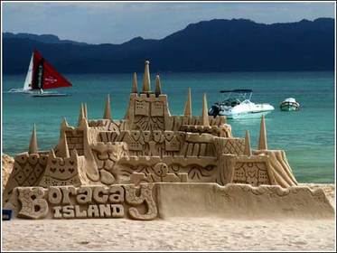
Boracay
-Approximately 315 km (200 miles) south of Manila and 2 km off the northwest tip of Panay Island in the Western Visayas region of the Philippines
-Part of Aklan Province, which became an independent province on April 25, 1956
-Famous because of its White Sand
-Weather in Boracay is generally divided into two seasonal weather patterns known locally as the Amihan and Habagat seasons
-One competitive venue for the Asian Windsurfing Tour.
Banaue Rice Terraces
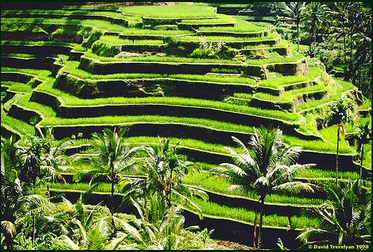
Banaue Rice Terraces/Hagdan-Hagdang Palayan ng Banaue
- Were built with minimal equipment, largely by hand
- National Cultural Treasure
-2,000 to 6,000 years old
-Eight Wonder of the World
-Free from Genetically Modified Organism (GMO)
- Were built with minimal equipment, largely by hand
- National Cultural Treasure
-2,000 to 6,000 years old
-Eight Wonder of the World
-Free from Genetically Modified Organism (GMO)
Chocolate Hills
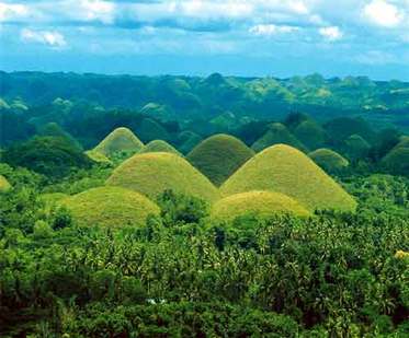
Chocolate Hills
- Consisting of Bohol Island and 75 minor surrounding islands.
-The province is a popular tourist destination with its beaches and resorts.
-The Chocolate Hills, numerous mounds of limestone formation, is the most popular attraction.
-The people of Bohol are said to be the descendants of the last group of inhabitants who settled in the Philippines called pintados.
- In that year on March 25 (March 16 in the Julian Calendar), a Spanish explorer named Miguel López de Legazpi arrived in Bohol to look for spices and gold.
Taal Lake
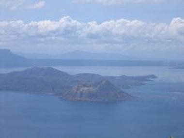
-Taal Lake is a freshwater lake in the province of Batangas, on the island of Luzon, Philippines.
-The lake is situated within a caldera formed by very large eruptions between 500,000 and 100,000 years ago.
-It is the country's third largest lake (the largest being Laguna de Bay).
-There is a crater lake on Volcano Island, which is in Lake Taal, which is located on Luzon Island.
-That crater lake is the world's largest lake on an island in a lake on an island, and it in turn contains its own small island, Vulcan Point.
Baguio City
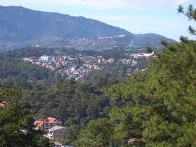
-Baguio City was established by Americans in 1900 at the site of an Ibaloi village known as Kafagway.
-Baguio City was designated by the Philippine Commission as the Summer Capital of the Philippines on June 1, 1903 and incorporated as a city by the Philippine Assembly on September 1, 1909.
-Baguio is the seat of government of the Cordillera Administrative Region.
-The name of the city is derived from the word bagiw in Ibaloi, the indigenous language of the Benguet Region, meaning 'moss'.
-The city is at an altitude of approximately 1500 meters (5100 ft) in the Luzon tropical pine forests ecoregion conducive to the growth of mossy plants and orchids. -Baguio City has become the center of business and commerce as well as the center of education in the entire Northern Luzon.
-According to the 2007 census, Baguio City has a population of 301,926.
